
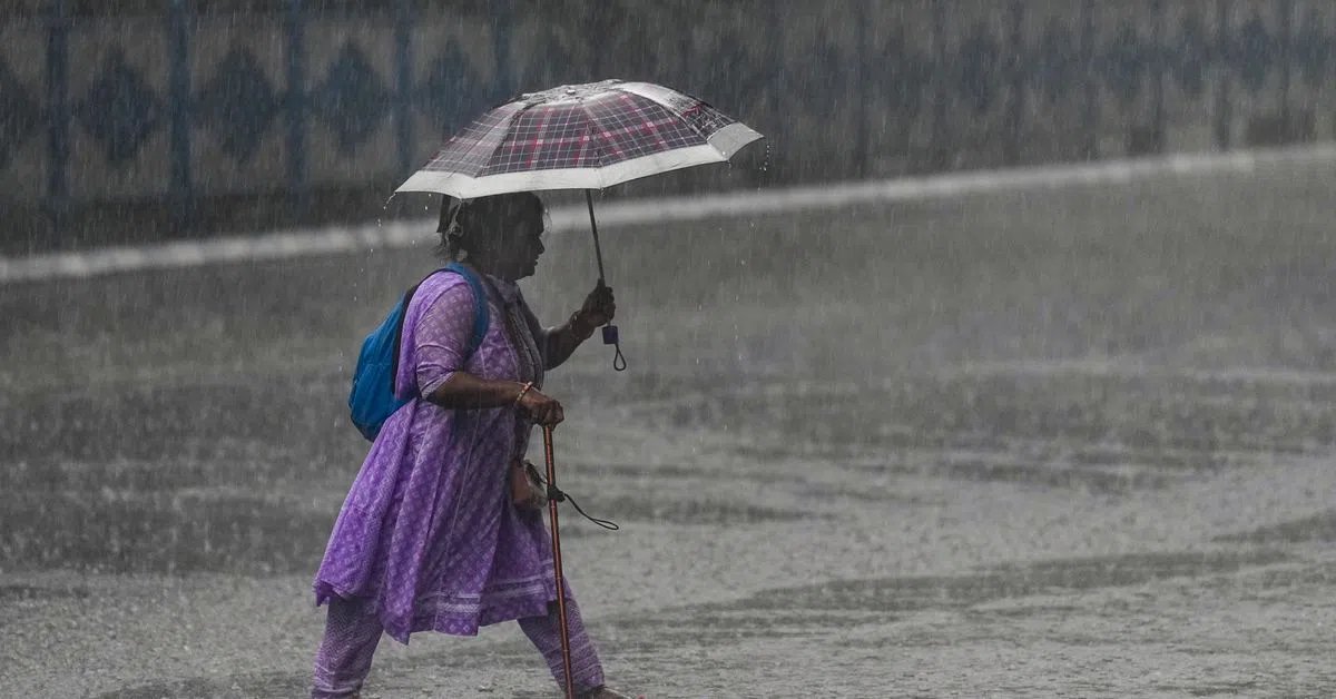
Delhi may witness a very light spell of rain accompanied by thunderstorms, lightning and gusting winds reaching up to 40-50 kmph on Wednesday as the India Meteorological Department (IMD) has sounded a yellow alert for the national capital.
Meanwhile, the southwest monsoon is set to advance further into parts of western, central and northern India over the next few days.
The weather department said conditions are favourable for the monsoon to move into more parts of Gujarat, Maharashtra, Chhattisgarh and Madhya Pradesh in the next two to three days, before extending into the remaining parts of Bihar and Jharkhand and some areas of Uttar Pradesh thereafter.
What is the weather forecast for Delhi-NCR?
Delhi and adjoining NCR areas are likely to witness a spell of very light to light rain accompanied by thunderstorms and lightning on Wednesday, with wind speeds reaching 40-50 kmph and gusting up to 60 kmph. The yellow alert remains in place as changing weather conditions are expected through the day.
Recent rainfall has already brought relief to parts of the capital, with Safdarjung, Lodhi Road, Delhi Ridge and several other stations recording light precipitation during the past 24 hours.
The minimum temperature settled at 26 degrees Celsius while the maximum temperature is expected to hover within the range of 38-40 degrees Celsius.
Where is the monsoon headed next?
After advancing into more parts of Maharashtra, Telangana, Karnataka, Odisha, Jharkhand and Bihar earlier this week, the southwest monsoon is now poised to spread further across western and central India.
According to the IMD, conditions are favourable for the further advance of the southwest monsoon into some parts of Maharashtra, Gujarat, Chhattisgarh, Madhya Pradesh, and the remaining parts of Jharkhand and Bihar in the next few days.
The northern limit of the southwest monsoon passes through Dahanu, Wardha, Raipur, Daltonganj and Motihari.
Which regions are likely to receive heavy rainfall?
Heavy rainfall activity is expected to remain concentrated over western and southern parts of the country.
Konkan and Goa are likely to witness the most intense spell, with heavy to very heavy rainfall and isolated extremely heavy rainfall forecast in some areas. Rainfall activity is also expected to remain strong across Madhya Maharashtra and Marathwada.
In southern India, widespread rain is forecast over Kerala, coastal Karnataka, Telangana and Lakshadweep, with heavy rainfall likely at isolated places. Coastal Karnataka and Telangana could witness particularly intense spells, while Tamil Nadu, Andhra Pradesh and interior Karnataka are also expected to receive significant rainfall over the coming days.
Across eastern and northeastern India, heavy rain warnings remain in place for parts of Bihar, Odisha, Sub-Himalayan West Bengal and Sikkim, Assam and Meghalaya, Arunachal Pradesh and the northeastern hill states.
Where are thunderstorms and strong winds expected?
Thunderstorm activity is likely to remain widespread across large parts of the country.
Northwest India, including Delhi, Punjab, Haryana, Rajasthan and Uttarakhand, is expected to witness thunderstorms accompanied by lightning and gusty winds. Similar conditions are forecast across Madhya Pradesh, Chhattisgarh and Vidarbha in central India.
Eastern states such as Bihar, Jharkhand and Odisha are also likely to experience thunderstorms.